Haleakala is a massive shield volcano that forms more than 75% of the Hawaiian Island of Maui. The western 25% of the island is formed by another volcano, Mauna Kahalawai.
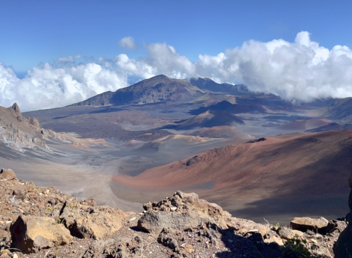
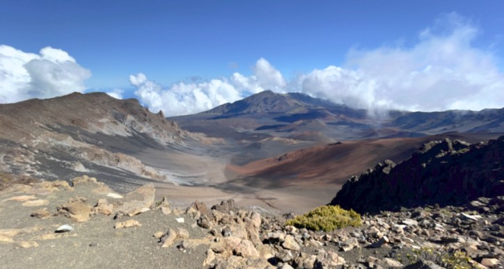
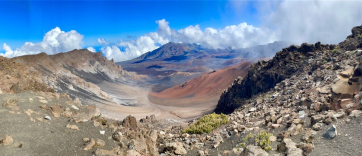
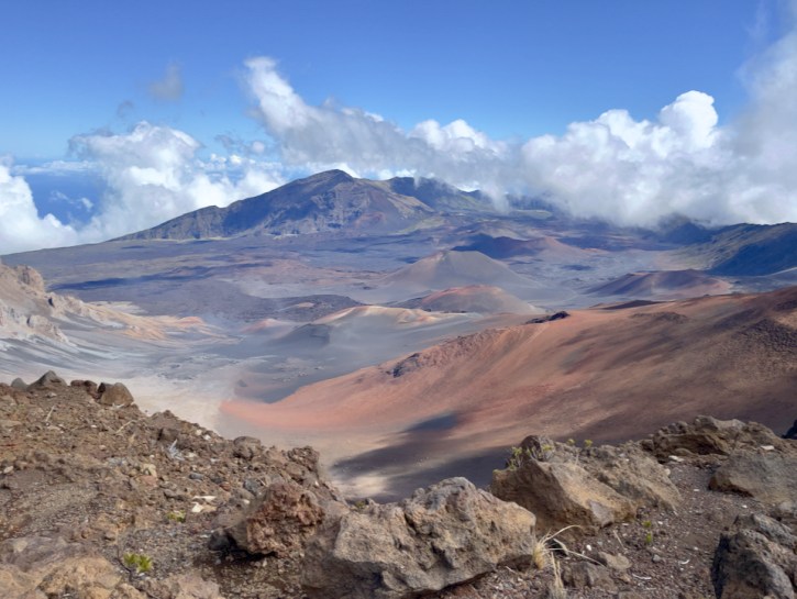
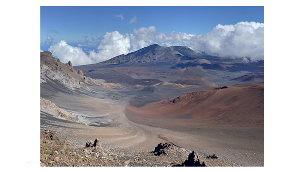
The tallest peak of Haleakalā (“house of the sun”), at 10,023 feet. From the summit one looks down into a massive depression some 7 miles across, and 2 miles wide, and nearly 2,600 feet deep. The surrounding walls are steep and the interior mostly barren-looking with a scattering of volcanic cones.
Haleakala has produced numerous eruptions in the last 30,000 years, including in the last 500 years. This volcanic activity has been along two rift zones: the southwest and east. These two rift zones together form an arc that extends from La Perouse Bay on the southwest, through the Haleakalā Crater, and to Hāna to the east. The east rift zone continues under the ocean beyond the east coast of Maui as Haleakalā Ridge, making the combined rift zones one of the longest in the Hawaiian Islands chain.[citation needed] In its prime, Haleakala may have reached a height of 12,000 feet before water and wind erosion, and possibly glaciers, began to carve two large river valleys out of the rim.[citation needed] Eventually, these valleys formed gaps that merged at the volcano summit to create a crater-like basin.
East Maui Volcano was previously thought to have last erupted around 1790, based largely on comparisons of maps made during the voyages of La Perouse and George Vancouver. However, in 1999, the U.S. Geological Survey published in a column that radiocarbon dating indicated that the last eruption was more likely to have taken place sometime between 1480 and 1600.[2][3] These last flows from the southwest rift zone of Haleakalā make up the large lava deposits of the Ahihi Kina`u/La Perouse Bay area of South Maui.
Contrary to popular belief, Haleakalā crater is not volcanic in origin, nor can it accurately be called a caldera (which is formed when the summit of a volcano collapses to form a depression). Scientists believe that Haleakalā’s crater was formed when the headwalls of two large erosional valleys merged at the summit of the volcano. These valleys formed the two large gaps — Koʻolau on the north side and Kaupō on the south — on either side of the depression. (All stolen from the web)